warehouselogistiek.eu
EN

The platform for internal & external logistics, supply chain and automation

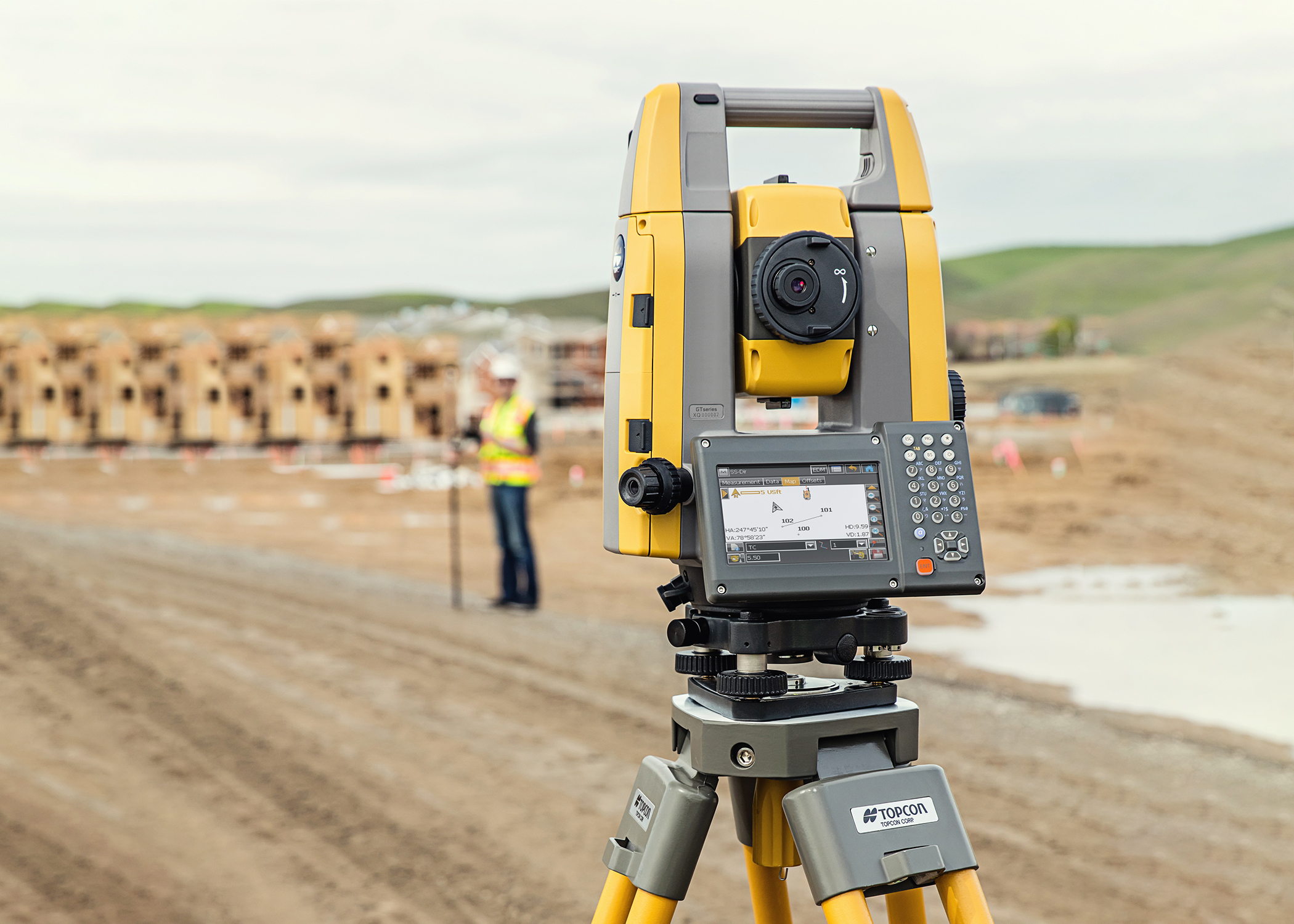
Topcon Positioning Group announces that the new GT Series robotic total stations will be available this fall. Areas of application include surveying surveying and laying out, construction surveying or as an aid to (construction) machine control. The GT-1200 and GT-600 total stations are available with different levels of accuracy.
The total stations are part of a complete workflow solution that includes, in addition to a new field book, a new version of MAGNET Field and Office software from Topcon and the latest GNSS receivers. All components function together as a unit, providing improved performance and data processing with integrated connectivity between field and office.
With the speed, tracking and accuracy of the GT Series combined with the intuitive software system, this flexible solution fulfills virtually all the technology needs of surveyors and contractors in their projects with plotting, measuring and machine control.
"The new total stations operate at an update rate of 10 Hz, which is faster than before. By linking the GT Series to the new field book with associated software, there is even better tracking and stakeout and sizing becomes easier. This allows the user to collect more stakeout and dimension points in less time," said Ray Kerwin, director of global product planning.
In the advanced UltraTrac prism tracking technology, optical detection is coupled with a newly developed algorithm that drives the UltraSonic motor and provides unprecedented performance in locking on prisms.
"In difficult project locations and machine control applications, it is now easier to track fast-moving targets and hold the prism lock. For example, in a machine control project, where the prism vibrates with the end of the blade, the GT now locks onto the prism better than ever. The result is that you can control the machine more fluidly," Kerwin explains to
As for the software, MAGNET offers improved quality reporting based on field data and better data processing for larger files, graphics processing and 3D models. MAGNET Field offers more workflows with images and maps, plus menu-driven functionality that is popular with users who work with the software a lot.
An optional upgrade is available that adds Hybrid Positioning technology. This allows users to obtain location updates directly from GNSS receivers. This allows data points for positions to be recorded even when line-of-sight is disrupted by obstacles on the project site
The complete GT–series workflow solution consists of the MAGNET-software, a FC-6000-field book and GNSS receivers from the HiPer Series. This total solution guarantees user-friendly digital processes that allow surveyors and contractors to work more accurately, have fewer retrospective adjustments and better quality control.
Need more information? Visit the Digital Intergeo.