warehouselogistiek.eu
EN

The platform for internal & external logistics, supply chain and automation
The infrastructure sector is in the midst of a massive digitization drive. This rather traditional industry is in a state of flux. Developments are going fast, especially in the field of Geo-ICT. Still with their boots in the clay, but high-tech driven. How do they manage that?
Mijdrecht-based Geodirect is more aware than anyone else of the effects of digital revolution in this traditionally rather traditional field of work and has a sharp, forward-looking vision of this. "There is nothing more beautiful and satisfying than really helping companies and organizations optimize and make work processes more sustainable," says Sales Engineer Eric van der Hoek. "We focused on the various facets within construction processes, where positioning and geo-information play a role. Mainly from the planning stage to the realization of projects."
Meanwhile, more than 10,000 users rely on the Geolantis KLIC Viewer app daily to prevent the risk of excavation damage.
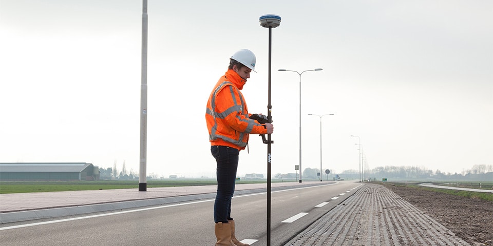
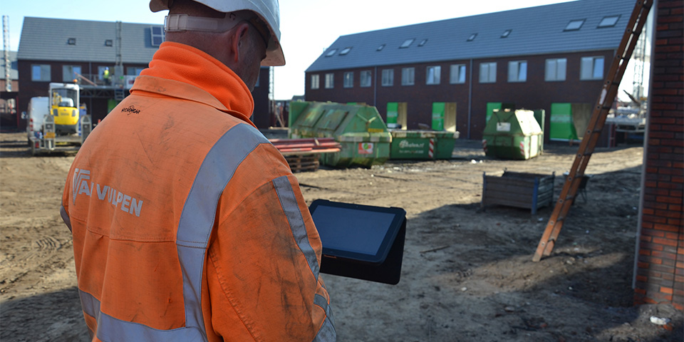
"We started in 2010 supporting contractors who wanted to measure and stake out using GPS in-house. The user-friendliness of equipment and software was essential, plus the intensive supervision of the people who had to start working with it," Van der Hoek continued. "When we started with Geodirect, we had one receiver at our disposal, the Stonex S9. One of the first receivers that simply had reception everywhere with centimeter accuracy, combined with software that did not require the user to have surveying knowledge. However, due to rapid developments in the market, we quickly realized that the software needed to be able to do much more. To really optimize processes, we started looking at alternative possibilities in terms of databases and links to other systems, such as ERP. This is how we came across Atlantis from iLogs, a unique system, developed for grid operators, with which much of what we were looking for was possible."
Van der Hoek: "Intensive cooperation with our relations to make the software environment suitable for the contracting industry, among others, ultimately resulted in our current Geolantis.360 platform. A number of drivers in the technical developments were, for example, the implementation of Synfra, in which we set up the complete process automation in the 24-hour house connection process for a number of contractors based on XML message exchange. At the same time, we developed the Geolantis.360 INSPECTOR app for the large-scale area management of the Port of Rotterdam Authority and integrated the entire KLIC process at the request of our customers. By now, more than 10,000 users rely on the Geolantis KLIC Viewer app every day to prevent the risk of excavation damage."
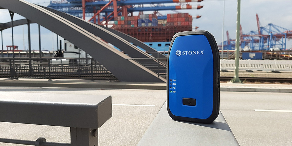
Stonex receivers are equipped with the most advanced GNSS board, deliver high performance up to 800 channels and support all satellite constellations.
Every day brings new challenges that allow Geodirect to continue to innovate. "The portfolio of complementary and always overlapping products grows organically with that," Van der Hoek states. "The deployment of drones is a great example of this. For measuring with drones, we started 3 years ago with 3Dsurvey software in combination with DJI's well-known drones. Later we expanded this with Pix4D, 3DR SiteScan and distribution of the WingtraOne drone. Our drone mapping solutions are used daily by many companies in the GWW. For example, to track the progress of earthmoving, determine actual quantities at asphalt plants and the rollout of fiberglass in the outlying area.
"Outdoor fiber optics is a great example of far-reaching process optimization," says Eric van der Hoek. "By deploying drones, telecom contractors have the current situation within less than half a day and can immediately determine the best route with centimeter precision. To arrive at the final design, contractors use the Geolantis.360 INSPECTOR app for surveying. During the inspection, we can even update the final design in real time using the unique database links, so that the contractor also has immediate insight into the costs, what work needs to be carried out (such as number of directional drillings, breaking up street work, digging trenches, etc.) and permits can be applied for and the materials ordered on time. The final design is then shared digitally with the engineers who also use the app. After construction, the engineers immediately take measurements with open trenches. Deviations from the design are registered with a GNSS receiver or digitally sketched in the COLLECTOR app and the revision is automatically synchronized with the work planner in the office."
Geodirect is currently working with a number of manufacturers, grid operators and contractors on applications in the areas of logistics and registration of processed materials in the subsurface. "This has some 'feet in the ground' given the different interests, but fortunately all parties are open to innovation and sustainability. After all, the digital revolution in GWW has only just begun," Van der Hoek concludes.
Vermogenweg 107, 3641 SR Mijdrecht
T +31 297 769 101
E info@geodirect.nl
www.geodirect.nl