warehouselogistiek.eu
EN

The platform for internal & external logistics, supply chain and automation
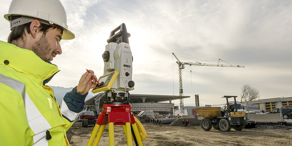
Leica Geosystems, part of Hexagon, has been revolutionizing the world of measurement and surveying for 200 years. Gradually the product portfolio has broadened to what the company is today: a total supplier for digital solutions with Swiss technology. Arno Kijzerwaard of Leica Geosystems talks about the evolution in measurement solutions.
Pioneers and visionaries of the measurement world, surely this is how we can describe Leica Geosystems with two centuries of experience. "Leica Geosystems originated with the founding of Kern & Co in 1819. Just under 100 years later, Heinrich Wild developed the T2, the world's first portable theodolite. This was in fact the basis for modern surveying. It didn't stop there. Meanwhile, our portfolio includes a wide range of solutions such as the DISTOTM rangefinders, lasers, cable detection, total stations, GNNS receivers, 3D laser scanners, mobile mapping and machine control. In short, the pioneering spirit is still in the genes, because we are still the number one company in the world when it comes to innovations in positioning."
The strength of Leica Geosystems, according to Kijzerwaard, is that the firm offers an enormously wide range of solutions in every area of measurement (positioning and geo-information). "Where previously the focus was only on the development of sensors, we now provide total solutions, both in terms of sensors and software. In doing so, we always try to create added value. For example, our Leica BLK3D combines a DISTOTM rangefinder with a 3D camera in one device. Photographs taken by the camera are perfectly usable in the workflow for measuring things, in the field, or afterwards in office photos. The same goes for surveying a project. The market increasingly prefers 3D laser scanning for surveying, where a colored point cloud is collected as a copy of reality. In that point cloud, one can then start modeling."
"There is also a shift in the construction and infrastructure industry from the traditional surveying-oriented total station to equipment designed specifically for construction, equipped with our Leica iCON Field software," Kijzerwaard continued. "Surveyors and dimensioners take the IFC model outside and see on site exactly in 3D in front of them what was conceived in the office, and that same model can be loaded our machine control solutions."
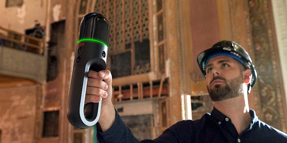
The Leica BLK2GO is a lightweight handheld mobile mapping device that digitally builds a 3D world of an object in real time, as you simply walk through a room
All data collected in the field, of course, must also be managed and processed. "The influence of mobile mapping is also becoming increasingly visible in the management of geodata," Kijzerwaard believes. "Data from our airborne Citymapper, for example, which combines laser scanning, bird's-eye views as well as perpendicular photographs, provides a very good basis for large-scale base maps. And on another level, we see that mobile mapping for example inside rooms is also taking off. Our Leica BLK2GO is a lightweight handheld mobile mapping device that digitally builds a 3D world of an object in real-time, while you simply walk through a room. The technique of data acquisition, or 3D copying of reality, has evolved tremendously and always with the Swiss precision required for the end result. What better way to add an accurate 3D copy of reality to the work process?"