warehouselogistiek.eu
EN

The platform for internal & external logistics, supply chain and automation

In Zoetermeer, an agricultural area was transformed into an area with a dual function: recreation and water storage. To create an as-built model of the earthwork - with the exact representation of heights and quay profiles - modern surveying techniques were used. For three days, a drone flew over the 350-hectare area. Then all the data was available for a fully covering 3D image with a high level of detail.
The 3D as-built model of the earthwork of the Nieuwe Driemanspolder came about through the collaboration between ADCIM and GeoZICHT on behalf of contractor combination the Dijkencombi. ADCIM is a consulting firm in civil engineering, infrastructure and environment. It provided support for part of the execution design and took care of the dimensioning of the structures. GeoZICHT - specialized in geodetic issues and inspections with drones - mapped the entire site from the air. They then processed the thousands of photos with photogrammetric software into usable geoproducts, such as a point cloud, terrain model and high-resolution orthophotomosaic.
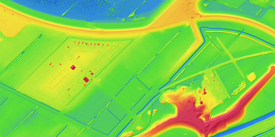
The whole exercise also happened at a rapid pace. "It took only three days of flying to map the 350-hectare area in detail and accuracy," says Jan Vermeer, team leader of Geodesy and 3D designer at ADCIM. "Within a few days all the data had been processed. A similar result with traditional surveying techniques would require at least four to five weeks of fieldwork and produce a less detailed model. Where the traditional surveyor would measure 1 point/5 m2 reports, the drone measures over 100 points/1 m2."
Bob van der Meij, drone specialist at GeoZICHT, notices that governments and companies are becoming increasingly familiar with the use of drones. Consequently, drones - especially when inspecting assets such as bridges, mapping terrains and realizing 3D models - provide a variety of added values. "We have a strong geodetic background," explains van der Meij. "Drones are a tool for us; we use them because they offer efficiency, quality, safety and reliability. In addition, we are ROC certified, a requirement because the area is in the airspace of Rotterdam Airport. Now that the industry and the market are becoming more professional, the number of applications is increasing."